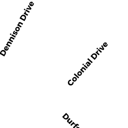
632 DENNISON DRIVE
Owner Information
KEKELIK PAULINE ESTATE OF
143 ASHLAND AVE
SOUTHBRIDGE, MA 01550-2901


Property Details
632 DENNISON DRIVE is classified as a Single Family Residential (Cape cod).
The primary structure on this property was built in 1935. There are 2,172ft2 of built area within this property. There is 994ft2 of residential/living space within this property. This property is listed as having 6 rooms.
632 DENNISON DRIVE is valued at $155,300. The land is valued at $35,100 and the structures are valued at $120,200.
This property is in Zone R1. Confirm with local Zoning Board authorities to ensure there are no overlays or other easements on this property.
The most recent deed for 632 DENNISON DRIVE is recorded at the local registrar in Book 0000, Page 0000. 632 DENNISON DRIVE was last sold on Wednesday, December 16, 1970 for $0.
Assessment data from fiscal year 2022.
Flood Data
According to the FEMA National Flood Hazard Layer, this property does not appear to be in a flood zone. It may also be in an area not yet reviewed. Nonetheless, confirm this information prior to taking any action.
To view the flood hazards around this property, create a FEMA "Firmette" Map of the area around 632 DENNISON DRIVE.
Broadband Internet Providers
| Provider | Type | Bandwidth (mbps) | |
|---|---|---|---|
| Charter Communications Inc | Cable | 940 | 35 |
| Verizon New England Inc. | DSL | 5 | 0 |
| Viasat Inc | Satellite | 100 | 3 |
| VSAT Systems, LLC. | Satellite | 2 | 1 |
| HughesNet | Satellite | 25 | 3 |
| GCI Communication Corp. | Satellite | 0 | 0 |
Broadband service provider data from December 2020.
Adjacent Properties
- 821 SOUTH STREET
Single Family Residential owned by PICKREN KEN - SOUTH STREET
Potentially Developable Residential Land owned by PICKREN KEN - 640 DENNISON DRIVE
Single Family Residential owned by STADNYK VASYL - 626 DENNISON DRIVE
Single Family Residential owned by BOHM RIC A - GRACE LANE
Accessory Land with Improvement owned by DORE TYMMOTHY